.comment-link {margin-left:.6em;}

canoeing, kayaking and other adventures

canoeing and kayaking adventures born in the Southeastern U.S. and now centered in Scotland...

Tuesday, July 31, 2007

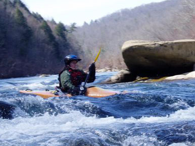
Camping, Cycling and Not Paddling the Tummel at Spate - 28/7/2007 - 29/7/2007

With my computer safely returned from the not very well trained monkeys at Dell's service department, I can finally catch up on a couple of tardy blog posts. This past weekend, Brian and I headed north despite the not so nice weather forecasts for Sunday and had a great weekend camping and cycling at the Tummel. With work underway at the dam, the popular run of the Tummel was huge. The S-bends and Linn were easily visible from the road, sharp, pointy teeth and all. I was much happier to be on a bike.

After a lazy Saturday morning, we set off toward Pitlochry figuring we could cope with bad weather if it found us. We found a great camping spot beside Loch Tummel, along the road to Foss, and set off for a short cycle. My guess is we did about 10 miles. We cycled from our campsite to the bridge where Amy taught some boys how to jump last year and had a good look at S-bends and the Linn from my preferred dry line. From there, we followed a path along the River Garry, which flows into the Tummel at Loch Faskally just below the Linn. The trail led us for maybe a mile along the Garry before we exited to the road into Pitlochry. The Garry looked like a good canoe camping possibility at the very end, but more scouting is needed to see if upstream would be suitable as well. After a brief stop in Pitlochry for a snack, sit and water pickup, we cycled back to our campsite along the Foss road. The little red book described the route as mostly flat with some hills. I'd call it gently rolling with some good hills, but that's partly my lack of fitness talking. We hit one good hill in between the S-bends and the get-in at the dam. Now that a couple of days have passed, I don't remember if it was my legs, lungs or back that said, "Quit it!" first, but that was the only spot where I walked. Definitely, I needed the walk. I do remember that. After a wee rest, we finished the last stretch of road back to camp.

Our campsite was midgy, not such a surprise considering it was summer and we were camping right beside the loch. I remember now that it was my back that complained first on the nasty hill. While Brian tended to fire ambitions, I took a back resting break away from the midges in the tent. The smoke from the fire eventually convinced the midges there was a better meal elsewhere, potentially our pot-smoking neighbors upwind. I cooked dinner while Brian continued to play with fire. With the daylight nearly gone, we called it a night not long after the meal.

The next morning, we packed up relatively early and set out on a much longer cycle. I'll say more about that later. In the meantime, enjoy the photos, below. It was a great day out.

Labels: , ,


Our short cycle on Saturday took us along and then across the last mile or so of the River Garry. It has a good grade 3 whitewater section, but this view had me wondering if it could be a good canoe camping river.

Labels: ,


Our campsite at Loch Tummel was nearly just across from the Queen's View.

Labels: , ,


Man make fire.

Labels: , ,


The view from Tummel Bridge had me wishing for my boat. Unlike the section below Loch Tummel, this stretch looked totally runnable and plenty warm enough for there to be warm rocks waiting below in case it doesn't go so well.

Labels: ,


In a rare moment, Brian was chasing me down a hill rather than the other way around.

Labels: ,


Queen's View with us backlit

Labels: ,


The Queen's View, without us in the way

Labels: ,


Rules schmules.

Labels: ,

Monday, July 30, 2007


The S-Bends on the River Tummel a year ago, when the dam broke originally and repairs meant that the water level was higher than usual. From my vantage point a pile of rocks in river centre, the main chute was a foam pile between a big pourover on river left and a small, submerged rock that isn't so obvious here. The water level was slightly higher in this spot the day we paddled it. The next day, when the kayak club came through here, they got to spend a few hours recovering a pinned boat from that slightly less submerged rock.

Labels:


The S-Bends approaching spate, yesterday. The pile of rocks where I was standing are river centre, just to the right of the tall, skinny tree in this photo. The big pourover I didn't like when the river was high (river left and slightly upstream from the now submerged big pile of rocks) looks even less inviting now.

Labels:


The Linn of Tummel at spate, yesterday. A year ago, it looked like this (view from opposite bank). I saw a line last year. I didn't want anything to do with that line, but I did see it. Yesterday? I saw less vertical drop and some sharp, pointy teeth where that second drop is normally.

Labels:

Monday, July 23, 2007

Blackmark Bushwhack and Aborted Glentrool Mission - 22/7/2007

Brian and I wanted to get the bikes out for the weekend and see how I fared with camping. Rather than commit to a wilderness trip, the plan was luxurious car camping. Rain had other plans. Saturday started out ok, but by midday, the heavens were trying to wash us away. As I gathered the last of our supplies for camping, Brian made other, non-camping accommodation plans. We spent the evening with Ron's parents in Moffat, where Brian finally fessed up to a liking of sherry. He kept drinking mine instead of his whisky.

The next morning, bright blue skies greeted us. We headed west past Dumfries to check out the plot of land that Brian was considering to buy and build a house. The spot where planning permission existed to build the house was among a plot of trees farther back from the pines and the overgrowth. We hiked, bushwhacked and squelched to get there. It took about 30mins. I left my camera in the car, so you'll have to trust me that it was pretty, remote and a bit midgy at times. We trekked back to the car by way of the burn at the property boundary.

Our choices of adventures were pretty big. I chose to head back toward Glentrool forest and St. John's Town of Dalry for a more wooded run than the wide open Southern Upland Way that ran past the property at Blackmark.

We set out on a more wooded section of the Southern Upland Way at Dalry heading west for the Glentrool forest loop. The big views loop at Glentrool is supposed to be 58km of fire roads. The Southern Upland Way shares some of the same trail in parts. The Southern Upland Way leading to Glentrool starts off with singletracky goodness but soon becomes grass with an indistinguishable path (except for the occasional waymark). The rocky sections interspersed with steep, grassy hills were too much for my unfit legs and still cranky low back. About half an hour into the ride/hike, I pushed the abort button. We bumped down the rocky bit next to the hydro station and cycled back to Dalry on the roads. Just as we entered the town, the skies opened up with the contents of the black clouds that had been looming for the past hour. Well timed! A juice in the pub sounded much better than getting doused in a downpour outside. When the rain let up, we headed for home.

Labels: , , , ,


Brian pushed the bikes up the non-path as dark clouds loomed ominously.

Labels: , ,